

A cold front is set to slice through southern Manitoba later today bringing more strong to potentially severe thunderstorms to Manitoba. The main threats will be similar to yesterday with small hail and heavy downpours. Below is the simulated reflectivity for today of what storms might look like on radar.

Manitoba
Area(s): South and central; severe area is most likely in the southwest
Timing: All day and through much of the night
Threats: 2-3 cm hail and 50+ mm of rain in the southwest; non-severe thunderstorms elsewhere
Thunderstorms will happen through much of the day and overnight. Severe weather is possible over southwestern parts of the province, where afternoon and evening thunderstorms may bring 50 or more mm of rain, and hail up to 3 cm in diameter.

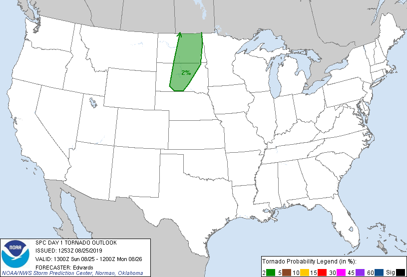
Stateside, the Storm Prediction Center has a SLIGHT risk of severe thunderstorms extending into Manitoba with a 2% tornado probability:
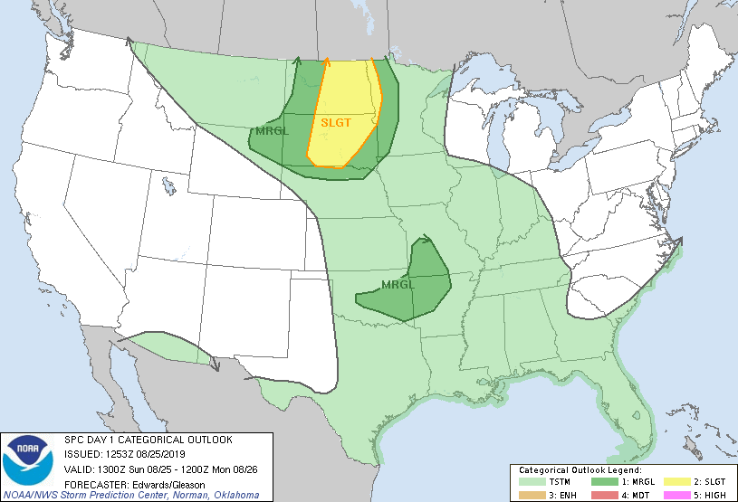
...Dakotas/northwestern MN... Scattered thunderstorms are expected to develop this afternoon as convergence related to the weak front and a surface trough impinge om a corridor of favorable moisture and buoyancy. A mix of organized multicells and a few supercells is expected, with large hail and severe gusts possible, while a tornado cannot be ruled out. As height falls and cooling/destabilization aloft spread across the warm sector, diurnal heating will further contribute to steepening deep-layer lapse rates, atop a plume of 60s F surface dew points near and west of the eastern frontal zone. Modified RAOBs and model soundings indicate that the peak MLCAPE -- behind the morning clouds/convection related to the initial perturbation -- should reach 2000-2500 J/kg, despite patchy cloud cover. 35-45 kt effective-shear magnitudes will support convective organization, as will strong upper-level/ventilating winds. Low-level flow will be modest and, in much of the area, veered west of southerly, limiting hodograph size. Overall weakening of convection is expected late evening into the overnight hours as remaining activity moves deeper into/atop a progressively more-stable boundary layer within and east of the slow-moving surface warm-frontal zone. In each outlook level, slightly more room as been allotted for this process to occur into northwestern MN.
Comments